
Email:
zhaizhongbing723@gmail.com
深圳市由你创科技有限公司 -- 软件行业的源头工厂


zhaizhongbing723@gmail.com


With the continuous development of UAV technology, it is more and more widely used in agriculture, logistics, aerial photography, environmental monitoring and other fields. As one of the key links of UAV application, route planning has a crucial impact on the flight effect and task completion rate of UAV. This paper will introduce the UAV route planning system solution in detail from the requirements analysis, system design, key technologies and other aspects of the UAV route planning system.

Uav route planning system mainly involves the following requirements::
According to the demand analysis, the UAV route planning system mainly includes the following modules:
Uav route planning system solution, by integrating a variety of technologies and modules, realizes the intelligent, real-time and optimization of UAV route planning, and provides strong support for the application of UAV in various fields. With the continuous development of UAV technology, UAV route planning system will play an increasingly important role.


Microscope Chromosome Karyotype Analysis Upper Computer Software Development
With the continuous development of biotechnological sci […]

Development of host computer program for electric servo test
The application of electric actuators in various fields […]
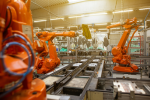
Development of an Intelligent Picking System for Robotic Arms Based on Machine Vision
Intelligent manufacturing is gradually becoming an impo […]

Custom Development of an Online Monitoring System for Production Equipment
The manufacturing sector plays an increasingly vital ro […]

Development of a Frequency Converter Upper Computer System
Frequency converters, as pivotal equipment for regulati […]

Custom Development of Ultrasonic Radar Testing Upper Computer
The demand for ultrasonic radars in fields such as auto […]
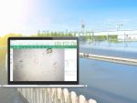
Software Development for Water Quality Algae Monitoring and Identification System.
Project BackgroundFaced with the professional detection […]
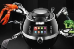
Smart Home Living Kitchen System: Dual-End Cooking Robot APP Development
Project Background To enhance the core competitiveness […]
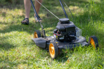
Smart Weeding Machine Android and iOS Mobile Dual-Platform Control APP Program Development and Customization
Case Background With the advancement of technology and […]
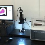
Development of an Automated Control Host Computer System for Laboratory Microscopes
Project Background A certain biotechnology company spec […]
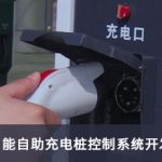
The development of an intelligent self-service charging station control system for new energy electric vehicles
Project Background With the development of smart grids, […]

Cross-border e-commerce shop agent declaration platform system: Oudai independent declaration software customization development
Case Background According to the new regulations on com […]


WhatsApp:
Email:zhaizhongbing723@gmail.com
Address:Zone E, 10th Floor, HongKong Shenzhen International Center, Longhua District, Shenzhen
©2024 unicrom. All rights reserved.

